Healthy Trees, Healthy Lives: Urban Tree Canopy
Already the second most populous state in the country, Texas is one of the fastest-growing states, with an estimated 1,000 people moving to the state each day. Rapidly growing communities must invest in quality infrastructure to better ensure a happy, healthy life for residents. Trees can help! Being around trees, even just having views of trees, is positively correlated to human health. The Healthy Trees, Healthy Lives (HTHL) initiative seeks to increase the collective understanding of the connection between trees and human health, and to transform the landscape to reflect that connection.
Texas A&M Forest Service leads the HTHL initiative in promoting healthier communities through an enhanced community forest that optimizes public health benefits. As part of the initiative, we analyze the spatial distribution of urban tree canopy and greenspaces relative to residential neighborhoods, hospitals, medical facilities, and schools and within non-highway rights-of-way. These geospatial analyses incorporate findings from nature and human health research and provide valuable insight for decision makers.
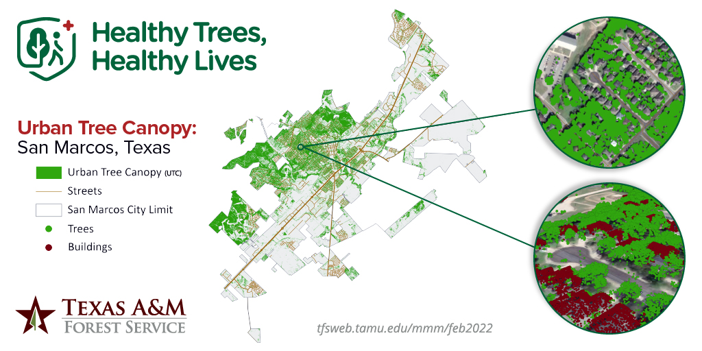
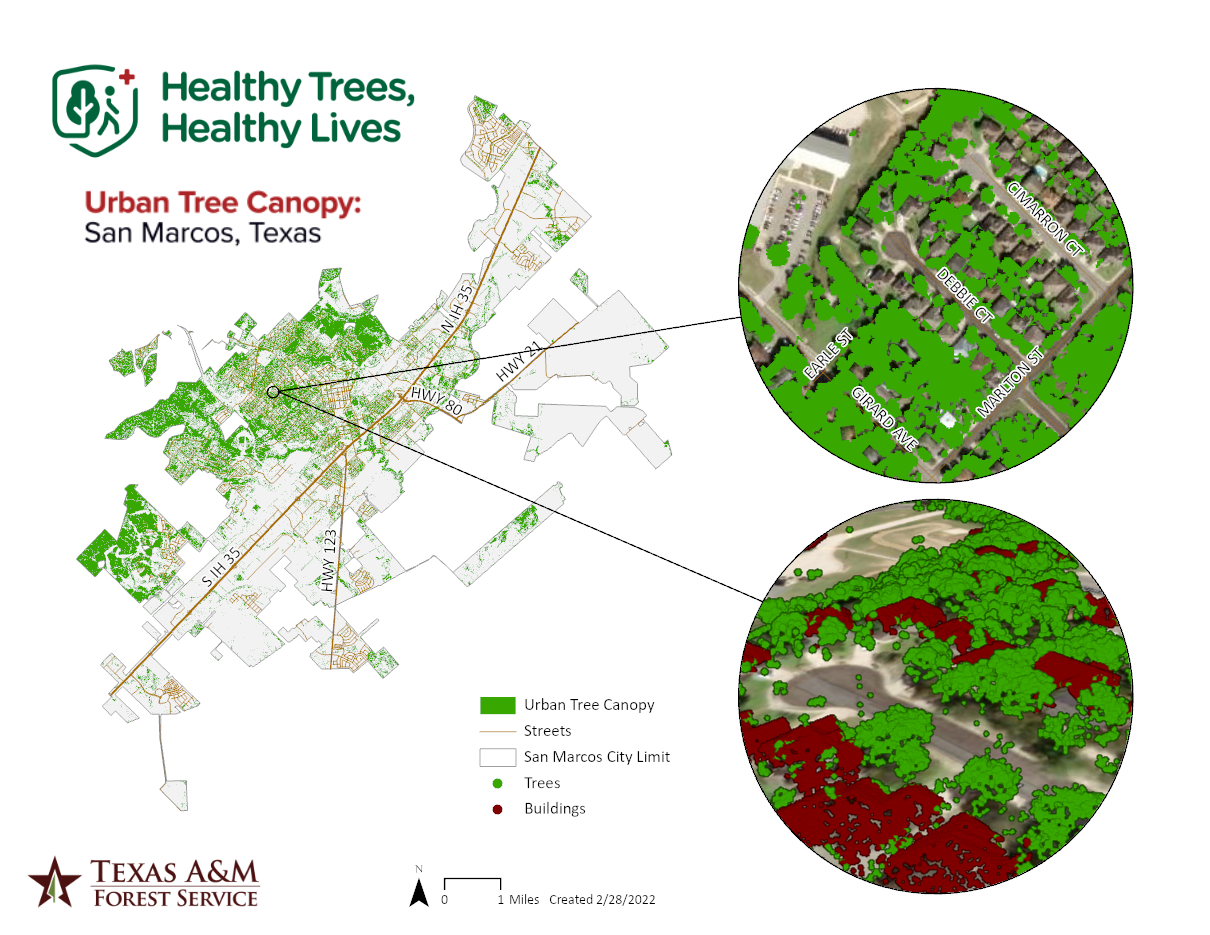
This map serves as an introduction to the HTHL geospatial analyses showcasing the type of data used to conduct the analyses. In the main part of the map and the top right corner, you can see urban tree canopy within the city boundary. This data comes from the Urban Tree Canopy (UTC) application on the Texas Forest Info website. In the bottom right corner, you can see a 3D view of LiDAR point data filtered and symbolized to show only trees and buildings. As described in the July 2021 Monthly Map Monday, LiDAR point data is increasing in availability, and we have been updating the UTC app with more current UTC layers created from LiDAR point data. This 3D view of the LiDAR data provides a unique perspective of the points that were transformed to create the UTC data. ArcGIS Pro was used to create this map and the proceeding maps to be highlighted in the following Monthly Map Mondays.
[Click to enlarge]

Stay tuned to continue to learn about how healthy trees can lead to healthy lives and explore the different maps Texas A&M Forest Service makes to assist Texas communities. More to come in the next couple of Monthly Map Mondays!
Join the conversation!
+ Contact
Rebekah ZehnderGeospatial Analyst
200 Technology Way, Suite 1281
College Station, TX 77845
979-458-6630 office
979-458-6633 fax
rzehnder@tfs.tamu.edu